EarthView team bios, guidelines, and more.

Friday, November 1, 2013

Spofford Pond School, Boxford -- Nov 1

42°41'46"N 
71°01'02"W
(Visit more about Lat/Long for ideas that combine math and geography learning.)

We have enjoyed several visits to Spofford Pond School in the past, and are delighted to be back this year. It is a school that really enjoys teaching and learning geography. In fact, during our visit we are learning about a special project the sixth graders are involved in a very special project in Global Citizenship.

The project is to raise funds for a foundation named Be Like Brit, which provides education and a home for children in the country of Haiti. As Spofford Pond students know, the foundation is named for Brit Gengel, a young local woman who lost her life in the 2010 earthquake in Haiti, while working to help children there. Because the earthquake caused so much destruction in Haiti, the Gengel family decided to help the people of Haiti while also honoring the loved one they lost.

The school is being built in Grand Goâve, but the EarthView team has not yet been able to locate it on Google Maps. This can be for one of three reasons: 1) the satellite imagery used by Google has not yet been updated; 2) it is located near the town, but not right in it; or 3) we just have not looked carefully enough.

CHALLENGE: We hope that someone from Spofford Pond School can help us find the school, and provide the exact latitude and longitude so we can update this post. Whoever finds it can let us know using the COMMENTS link below this post. Hint: Look at the Orphanage Photos page on Be Like Brit for some visual clues.
View Larger Map to explore the area. How far is it from the capital city? While looking at Haiti, compare its forest cover to that of neighboring Dominican Republic. One important reason for the extreme poverty of Haiti is the destructive practice of forest removal by French colonizers over 200 years ago. 

Early on the day of our visit, an earthquake occurred at 30.298°S 71.557°W. Notice that these coordinates are presented in degrees and decimal portions of degrees, rather than degrees-minutes-seconds. Still, the information provided is enough to figure out the country where this particular earthquake took place.

ANOTHER CHALLENGE: Where was it? What ocean is very nearby?
(The answer is at earthquake.usgs.gov. Don't click until you've tried to figure it out!)

In 2010 -- just a few weeks after the earthquake in Haiti -- this South American country experienced one of the strongest earthquakes ever recorded. It caused a lot of damage, of course, but much less than had occurred in Haiti. At the time, we posted an article providing several geographic reasons that the earthquake in Haiti causes so much more damage than the one in South America. Learn more about Haiti from the Help. Hope. Haiti. blog established at Bridgewater State University in the weeks following the 2010 Earthquake.

Several times during our visit, the Globe Lady discussed tropical rain forests with several of the classes. As she mentioned, it is sometimes surprising that rain forests are actually quite difficult places for farming. Although rain and warm temperatures are good for crops, the constant rain and heat that sustains the tallest forests actually makes it difficult to grow crops. The heavy rain leaches nutrients from the soil, and the constant warmth provides an abundance of crops, many of which love to eat crops! It is sometimes surprising to learn that the most productive biome supports very small human populations. The effect is visible from nighttime satellites images, on which rain forests look mostly empty.

The great variety of species -- biodiversity -- in tropical rain forests allows them to survive in this difficult environment. No insect is interested in all of the varieties of plants, and the complex layers of vegetation and epiphytes allow nutrients to be cycled above ground -- sometimes right through the bark of trees!

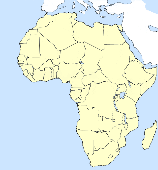
As the the globe lady pointed out, rain forest biome is found in many locations around the equator, where the temperature and moisture conditions are the same. These include the rain forests of the Congo Basin, Indonesia, and the Amazon Basin. EarthView team member Dr. Hayes-Boh became a geographer because of his interest in the Amazon, and has written quite a lot about one particular part of the Brazilian Amazon -- the state of Rondonia.

We also sometimes describe the Wedding of the Waters, where the Amazon River is formed from the Rio Solimões (which is cloudy with sediment from the Andes) and Rio Negro (which is clear and dark with the tannic acids of the northern tributaries). The confluence of these rivers in Manaus is considered by many to be the start of the Amazon River, which flows so slowly that the two rivers do not mix for many miles.


View Larger Map

Thursday, October 24, 2013

Back to North Andover


The EarthView team was very please to return to North Andover for the fifth annual Family Geography Night, which has been recognized throughout Massachusetts for its success of bringing an entire community together to learn and enjoy geography!

For more information about North Andover and these programs, please see previous North Andover posts on this blog and in its archived precursor (from BSC days). Each visit has allowed EarthView to be enjoyed by more than 800 members of the North Andover community.

Friday, October 4, 2013

North Reading Middle School -- Oct. 5

42° 34' 36" N
71° 05' 17" W

Learn more about Lat/Long

EarthView returns to North Reading today, on the 56th anniversary of the Soviet satellite Sputnik. This small, simple satellite could do nothing more than send a simple "ping" message back to the surface, but the fact that the Soviet Union was able to launch it before the United States energized the space program under Presidents Eisenhower and Kennedy, eventually leading to human exploration of the moon.

Many of the tools that were developed as part of the space program are now used by geographers to learn more about the earth itself. These include earth-exploration programs such as LANDSAT, which monitors land use and conditions on a regular basis. It is also the basis for Global Positioning Systems (GPS), and for Google Maps and many other web sites that show what the earth looks like from above.

During some of the EarthView sessions today, Dr. Hayes-Bohanan described his visits with students to Cerro Negro and to the nearby volcanic islands in Lake Nicaragua. These islands are formed in a very unusual way, as each is a small piece of a large flow of lava from the nearby volcano Mombacho. Zoom out to see the relationship between the islands and the volcano. Zoom in to see the houses that occupy many of the islands. Some are the humble homes of people who earn their living fishing in Lake Nicaragua, while others are the vacation homes of some of the wealthiest families in Central America.


View Larger Map

Learn much more from our volcano roundup post.

Quashnet School, Mashpee -- Sept. 27

41° 37' 27" N70° 29' 41" W

Learn more about Lat/Long


EarthView's went to Cape Cod for its first program of the autumn season. Previous visits to Mashpee have been to the Middle School at  41° 36' 57" N, 70° 30' 34" W. Use the "Learn more" link above for ideas on how to use these coordinates for activities at home or in the classroom.
One of the great things about the Quashnet school (which has both an active web site and a frequently-updated school blog), is its labyrinth, visible here from Google Maps. 


View Larger Map

At least two members of the EarthView team completed the labyrinth, which is distinct from a maze, in that the proper route is not a mystery or puzzle. Rather, the maze provides an opportunity to calm the mind and enter a centered, balanced state that facilitates learning.


Our visit took place shortly after a new island was formed near the coast of Pakistan on September 26. This island is just about the size of a football or soccer field, and about 60 feet tall at the center. Because the internal pressure of volcanic gases is largely responsible for the emergence of the island, it may soon collapse below sea level, so that the world's newest island will probably soon be an extinct island.


Thursday, August 1, 2013

Bridge Program -- July 12 & August 1

41°59'17"N 
70°58'21"W

Usually EarthView travels in a BSU van (we dream of getting a globe-painted van some day), but for this summer's special program for middle and high school students from New Bedford and Brockton, we were able to roll EarthView to the event on its luggage cart! To our location in the Kelly Gym, we had to travel only the smallest fraction of a degree of longitude, having started in the neighboring Math & Science Center, whose coordinates are: 

N 41°59'17"  
W 70°58'19"

These EarthView presentations are part of two sessions of the Bridge Partnership, each lasting two weeks. Students come from the cities to the north and south of Bridgewater for a taste of campus life and field trips include special places in the home cities of the participating students.

EarthView team member Dr. Hayes-Bohanan lives right next to the BSU campus, but has spent a lot of time in both Brockton and New Bedford, and enjoys learning about the geography of each. The reason? Each is a local place with fascinating global connections!

Wednesday, June 12, 2013

Across Two Fridays

The EarthView Experience map includes all of the visits we have made with EarthView, but this is such a busy week for EarthView that we decided to make a separate map just to show its travels from June 7 to June 14, 2013. This busy pace has been made possible by the fact that most K-12 schools are in session while BSU is on a summer schedule. More importantly, we have relied on current, former, and future EarthView wranglers from the Geography Department, along with a graduate of our EarthView Institute who is bringing EarthView to her own school.


View Across Two Fridays in a larger map

Saturday, June 8, 2013

Continental Shifts

During our most recent EarthView presentation, as Dr. Domingo was speaking about Africa, a question came to mind for Dr. Hayes-Bohanan (who is writing this post). Noting that we always emphasize that it is a continent (when nearby islands are included) of 55 countries, the question came to mind: Where would the population of Africa rank if it were a country?

The search for information about population by continent led to a simple presentation by geohive of population changes by continent over the 1950-2050 century. As explained in our Population Primer article last year, this is the "bottleneck" century, of critical importance to the long-term balance between the population of humans and the health of ecosystems.

The shifts growth in population and the relative proportion among continents is described by this series of pie charts. The use of circles is perhaps not the best way to compare overall population, since the numbers are represented by area but the eye tends to compare diameters.


The pie charts what proportion of the population is on each continent at 25-year intervals. In reality, these are not continents in the physical sense, but major regions that make for convenient comparisons. One must look carefully to identify some of the important changes during this century. Most dramatic, is the decline of Europe's population, which has just half of the share of total population that it did only six decades ago.

The key to the charts includes Oceania, but with about one-half of one percent of the world's population throughout this century, it is not visible. How does this compare to the proportion of EarthView (and of the earth itself) occupied by these countries, which include Australia and all of the islands of the Pacific?

More About Continents

Oceania is not a continent, nor are many places in the world, though people ask geographers to assign islands to continents all the time. Geographer Matt Rosenberg addresses some of the most frequent questions that start with the words Which Continent? To understand his answer to the question about Greenland, look at EarthView or any map that shows North America and Greenland with their continental shelf.

Activities

Visit the article on geohive to see the numbers behind the charts above. Which regions have maintained their share most consistently, and which have grown the most in relation to other continents?

Experiment with other kinds of graphs -- such as bar and line graphs -- to see which are most effective at communicating the changes experienced during this period.

Finally, address the original question: If Africa were a country, what real country would be closest to it in the population rankings? 

You can answer the previous question for each continent except Asia. Why is Asia the exception?

World Cup 2014

Throughout the 2013-2014 school year, look for more information about the geography of football, which is known as "soccer" in the United States. In June and July 2014, The World Cup championships will be held in Brazil for the first time since 1950.

As most fans know, Brazil has won the Cup more often (five times) than any other country, and the game is among the country's most important pastimes. For this reason, the 2014 Cup is expected to be followed with special attention around the world. It will be an excellent time to learn more about the geography of a vast and dynamic country that has experienced many exciting changes in recent years.

Because the tournament involves many teams in several rounds, stadiums in 13 cities will be used, so that viewers of the games will have the opportunity to learn about all of the major regions of what is a far more diverse country than most people realize.

Because members of the EarthView team -- and several of the BSU alumni who have been involved with EarthView in the past -- have extensive experience in Brazil, this EarthView blog will include both academic and first-hand accounts of the geography of Latin America's largest country.

Massachusetts is home to a growing number of people from Brazil or people from the United States who have visited Brazil. The Bay State also has a growing number of economic and academic connections to Brazil, so the World Cup focus comes at a very important time for the Commonwealth of Massachusetts.


Map: Wikipedia
For now, detailed information about the Cup and its venues can be found on Wikipedia and FIFA. Return to this blog throughout the coming year!

Monday, June 3, 2013

Litterati

Some geography students who are old enough to have an Instagram account might already be in the habit of taking photographs of their food. This is the story of a father who was walking with his young children and came up with a much better -- and richly geographic -- use of the technology. This short video explains how Litterati was created, and how it can be used to help create a cleaner planet.

Wind and Water

Our colleagues at Listen Edition have posted two recent articles of particular interest to geography educators, both related to weather and climate. Listen Edition is a new blog that serves as a sort of educational concierge of stories from public radio. Teachers in any discipline can use the site for audio, lesson ideas, and in some cases, detailed lesson plans.

Map from the original
NPR Storm Surge story
The first is Storm Surge Science, which describes efforts to communicate more effectively about the geography of storm surges. As Hurricane Sandy demonstrated, the high water driven ashore by hurricanes can be among their most important effects, but many people have not known how to interpret information about the surges. Cartographers and other scientists in New York City and at the National Hurricane Center in Miami are therefore working to create maps that are more effective than the language that has been used in previous storm warnings.

The other story is not going to be directly relevant for a while, but is nonetheless interesting. Canadian volunteers stepped into freezing wind tunnels to calibrate the traditional formula for Wind Chill Factor. A new formula has resulted that more accurately describes how cold a person would fee if exposed to a particular combination of wind and temperature. This story is accompanied by a complete lesson plan.

Friday, May 24, 2013

Sharon Middle School -- May 24

42° 06' 24" N
71° 09' 58" W 
Learn more about Lat/Long (including how to look them up by address)
Also, compare today's coordinates to those of other recent EarthView outings, near and far!
 

This is EarthView's second visit to Sharon Middle School. (We were originally scheduled for the Ides of March, but were snowed out.) The blog post for our April 2012 visit describes the town of Sharon in terms of both site and situation -- geographic characteristics of the place itself and of the place in relation to other places. 


Today the EarthView team celebrates Sathwik Karnik's victory in the Natiional Geography Bee. The Karnik family of Plainville, Massachusetts is well known to us, as both Sathwik and his brother have been state bee champions and national finalists.

His winning answer was Chimbarazo, the world's tallest mountain, when measured from the center of the earth.

View Larger Map

Today is also a good day to talk about MOVEMENT, which is one of the Five Themes of Geography. This theme refers to the movements of people, products or ideas that connect PLACES.

May 24 is the anniversary of at least three important events that made future connections possible, and last night a bridge collapse led to a temporary but important loss of connection.

In 1844, the "Victorian Internet" began, as Samuel Morse sent the first telegraph message from Washington to Baltimore. The map below shows another kind of connection between the two, along the Interstate Highway System.


View Larger Map


During the EarthView presentation, Dr. Hayes-Bohanan mentioned the unusual relationship between the telegraph and the Brazilian city of Porto Velho. The connection is explained in the 1999 article Post-Frontier Towns of Rondonia, Brazil, with much more information about the region at Rondonia Web.


On this date in 1883, the Brooklyn Bridge connected the two largest boroughs of New York City -- Manhattan and Brooklyn. John Roebling had constructed a similar bridge connecting Covington, Kentucky to Cincinnati, Ohio in 1866, but it is not quite as famous.


View Larger Map


In 1976, supersonic commercial air service connected both London and Paris to Washington, DC, as a Concorde SST was sent from each city to Dulles Airport in nearby Virginia. (The mother and aunt of EarthView team member Dr. Hayes-Bohanan were both there, but he had to go to school that day!) The map below from Geography of Transportation at Hofstra University shows all of the Concorde routes, since retired.

Finally, as mentioned above an important loss of connection occurred last night, when the Skagit River bridge over Interstate 5 collapsed. At least one small truck fell into the river, but nobody was severely injured. The bridge has been described as a major connection between the city of Seattle and the country of Canada. Google Maps already shows that segment as missing, so that navigation systems relying on Google Maps will not send drivers that way. Explore the map to see how difficult the rerouting of people and cargo will be while the bridge is being repaired.

View Larger Map


Monday, May 20, 2013

Is the Gulf of Mexico Being Harmed by Snot?

Public Radio for the Classroom
No, but scientists have described a "snot-like substance" as a serious problem for the food chain in the Gulf of Mexico, three years after the Deepwater Horizon spill there.

Map: Britannica

Tuesday, May 14, 2013

Dry Rivers


One of the most important lessons of the EarthView program is how water can be scarce on a planet covered with water. We learn that only one percent of the world's water is fresh, liquid water that is potentially usable for secondary human uses such as crops, livestock, and industry or primary uses such as bathing, cooking, and of course drinking.

Unfortunately, much of that one percent is at risk. National Geographic has recently published photographs from eight important rivers that do not always reach the oceans or seas to which they are connected on the map. It may be that some of EarthView's rivers should be drawn with a dotted line.

Friday, May 3, 2013

Raynham Middle School -- May 3

41° 56' 49" N
71° 02' 14" W 
Learn more about Lat/Long (including how to look them up by address)
Also, compare today's coordinates to those of other recent EarthView outings, near and far!
 

Today EarthView is traveling just a short distance, to our neighbors at Raynham Middle School Access the EarthView Experience map to see just how far we have traveled today.

May 3 is the birthday of musician and conservationist Pete Seeger, whose work in protecting the waters of the Hudson River has been a great example. It is also the anniversary of the founding in 1802 of Washington, DC on land donated by Maryland and Virginia (the Virginia portion did not remain part of the city following the Civil War).


It is also the attainment day of EarthView team member Dr. Hayes-Bohanan and the birthday of his mother. Both of them were actually born in the District of Columbia -- the only place that is part of the United States but not of any state.


Our visit also comes on a beautiful, clear spring day in coastal New England. In this part of the world at this time of year, the daily range in temperature can be quite dramatic. The image at the right was captured from weather.gov a few days ago.


The images below are not quite as dramatic, but do show the importance of continentality, especially on dry days. Note the distance from the ocean of each of the communities shown, and calculate the difference between high and low temperatures each of the next couple of days and nights. What pattern can you discern?


Coastal:


Transitional:


Interior (note that this morning's temperature reading for Worcester is about an hour later than the other two):


During our visit, we had the pleasure of meeting two RMS students from Cape Verde -- Joel from Pedro Badejo on the island of Santiago, where Dr. Hayes-Bohanan took BSU students in 2006, and Vanessa from Fogo, where Dr. Hayes-Bohanan will be taking students in 2014. We took the opportunity to share some special lessons about Cape Verde's geography.

Monday, April 29, 2013

Trade Atlas


From the Massachusetts Institute of Technology (MIT) in Cambridge comes a fascinating online atlas that has no maps in the traditional sense. The Observatory of Economic Complexity is a model of all the world's imports and exports. The scale of the map represents the percentage of trade in any given category. The legend includes shading by type of export -- food, transportation, medical, and so on -- or by region of the world for some of the charts.

Users of the chart can examine the trade between any two countries, or between a single country and the entire world. Warning: this is so interesting that it can be habit-forming!

The atlas does not include three very important ways that money can flow between countries, some of which can be important in certain cases. It does not include tourism, donations of aid, or remittances (which are funds sent by migrants working in another country back to their families at home).

Zipper-dee-doo-da!

The EarthView blog often includes anniversaries related to geography. Today is the centennial of an event that is essential for EarthView itself. On April 29, 1913, Gideon Sundback received a patent for the modern zipper. 


His design was an improvement on the work of others, but it was such a dramatic improvement in simplicity and reliability that Sundman is widely considered the inventor of the modern zipper. Last year his birthday -- also in April -- was recognized by a Google doodle.


As we mentioned when the EarthView zipper was replaced about a year ago, without the zipper, EarthView itself would be impossible. To keep the zipper working smoothly, the EarthView wranglers frequently apply natural beeswax to its zipper.


Wednesday, April 24, 2013

EarthView at Stoughton

Through the occasional offering of EarthView Institute, Bridgewater State University is able to offer "EarthView Driver's  Licenses" to geography teachers throughout the region who wish to implement geography programs in their own schools. Stoughton's John Gunning and Rachel Killian were among the first to complete the course, enabling them to lead an exciting two-day program at the O'Donnell Middle School this week.

See the Wicked Local article Middle School Students Celebrate Earth Day in a BIG Way for more photos and details.


Tuesday, April 16, 2013

Oceans Five

Oceans are defined by a combination of their underlying geology, patterns of circulation, and human interaction. Just 13 years ago, a fifth ocean was "created" by defining parts of three others as a new entity, based on a prevailing current that circles Antarctica.
Click image for a better view.
As described on Geography.About.com, the Southern Ocean was defined in the spring of 2000. What was the only ocean at that time that did not cede part of its area to the new creation? The Southern Ocean is defined by the 60th parallel of southern latitude. This is not the one shown in yellow above, which is the Antarctic Circle, and which is very close to the Antarctic coastline on the eastern side. Rather, it is the parallel that is shown between 55 and 65 degrees. This corresponds very closely to the edge of the floor in EarthView, where Antarctica and the Southern Ocean are the only parts of the globe that are not hand-painted.

Read the oceans article on About.com for interesting information about each of the five oceans and their geographic importance. For the story about how the identity of the Atlantic Ocean came to be known so late in human history, see Biography of an Ocean (note that this article is on the archive version of our blog at its previous address, where many geography articles can be found).

Tuesday, April 2, 2013

Out of this World -- Sort Of

The geographers at Bridgewater State University are fortunate to have good relationships with geographers around the world. One of these is Dr. Francisco Henrique de Oliveira of the University of the State of Santa Catarina in Florianopolis, Brazil. As a specialist in surveying and mapping, he shares many interesting stories and images related to geotechnology.

He recently shared this graphic, which compares seven satellite orbits, including those of the International Space Station (ISS) and the the Global Positioning System (GPS). The highest orbit shown is the geostationary category, which includes a variety of satellites -- such as those used for television -- that need to stay in a constant position over the earth. (Learn more about GPS from our Where We Are post.)


We are working on exercises to compare these orbits at EarthView scale. For example each of the 24 satellites in the GPS system would orbit about 30 feet away from the surface of EarthView.

Please notice a few things about the diagram.

First, although it might seem to imply that all orbits run over the North and South Poles; this is not the case but simply makes the diagram readable.
Second, notice that the distances are expressed both as height above sea level and radius from the earth's center; the difference, of course, is the radius of the earth, about 4,000 miles.
Third, notice that the speed varies with height, with lower-orbiting satellites moving much faster than those at greater height.
Finally, notice that the time required to complete a full orbit increases with height; this is relationship between increased circumference and decreased speed as height increases.

Friday, March 22, 2013

World Water Day -- March 22

During our visit to Tenney Grammar School in Methuen, the EarthView team celebrated World Water Day, which has been recognized by the United Nations since 1993. Secretary-General Ban Ki-moon explains the importance of the day.


Tenney School's participation in World Water Day has been recognized by the United Nations!

See the UN Water Day Interactive Map

Check out how we celebrated World Water Day inside EarthView!


World Water Day reminds us of the early weeks of 2010, when the EarthView team followed the progress of Katie Spotz and her record-breaking effort to generate awareness of the need for clean water. She raised $150,000 dollars for clean water as she entered the record books. See Row for Water to learn all about her journey.

Thursday, March 21, 2013

Tenney Grammar School - March 22

42° 43' 52.608" N
    71° 10' 38.7732" W
Learn more about Lat/Long (including how to look them up by address)

The EarthView team is excited to be at Tenney Grammar School in Methuen! We have heard you are studying all about the world in Geography class, specifically your focus on the continents of Asia, Africa and Europe. What geographical information have you learned about these continents?


Something you may not have learned about Europe is the recent discovery of fossils, dating back to the time of dinosaurs! A 9 year old girl has recently discovered a new species of pterosaur after taking a walk on the beach. Daisy Morris of England was walking along the Isle of Wight, and saw blackened bones sticking out of the sand. Daisy and her parents immediately brought the fossil to Martin Simpson who is a paleontologist at the University of Southampton. The fossils were examined and paleontologists came to the conclusion that it was a new species of Pterosaur. A pterosaur is a flying reptile that lived among the dinosaurs. The new species of pterosaur was named Vectidraco daisymorrisae, after its 9 year old finder. The Vectidraco daisymorrisae was said to be an expert flyer, living about 145 to 65 million years ago. The Pterosaur was only a foot long, similar to a crow. A new children’s story titled “Daisy and the Dragon” was written by Martin Simpson, shortly after the discovery.

                                                  An illustration of a flying pterosaur.


Today is March 22nd which marks the 16th anniversary since the sighting of Comet Hale-Bopp!


Comet Hale- Bopp was a comet discovered by Alan Hale and Thomas Bopp on July 23, 1995. The center of the comet is estimated to be about 24 miles wide! Hale- Bopp comet set the record for being visible on Earth for 18 months. Although it was visible for 18 months, 16 years ago today on March 22, 1997, Comet Hale- Bopp had its closest approach to Earth! This comet is one of the brightest comets to reach the inner solar system in history. The comet is currently just beyond the orbit of Uranus, but it can still be seen by a telescope. This viewing of Hale- Bopp comet is expected to last until 2020, and then will not return again until the year 4534!


Another fact about today is that it is World Water Day!

How much water do YOU usually use in one day? Did you take a shower? Brush your teeth? Flush the toilet? Wash your hands? Eat food? Drink a water bottle? 
Today is World Water Day! World Water Day was declared by the United Nations General Assembly on March 22, 1993. In order to support World Water Day, people are encouraged to not use their tap water throughout the entire day. The purpose of Water Day is to spread public awareness and encourage water conservation is everyday life. There are billions of people around the world without access to safe drinking water. Many families have to walk far distances just to get a glass of water to drink! Many people are celebrating with different events all over the world, but this year’s official Water Convention will be held today in South Holland hosted by the Government of The Netherlands. The theme for this year’s celebration is ‘Water Cooperation’. For more information you can visit

http://www.unwater.org/water-cooperation-2013/home/en/

How will YOU celebrate World Water Day?       


Monday, March 18, 2013

Cape Verde: Global Crossroads

Southeastern Massachusetts is home not only to EarthView, but also to many thousands of people from the Atlantic island nation of Cape Verde. By some estimates, more Cape Verdeans live in Massachusetts than in Cape Verde itself, because the Cape Verdeans here include people who arrived last week, people whose ancestors arrived on whaling ships more than a century ago, and generations of arrivals in between. Many of those migrants arrived on a ship that can be found in New Bedford Harbor to this day, the Schooner Ernestina, a former whaling ship that became the last vessel to bring migrants to the United States under sail.
Map source: Sandgrains, a film about resource depletion in Cape Verde
This map is more accurate than the current
Google map of the islands, which includes a major error.
The connections between Cape Verde and our region are very strong, but Cape Verde's geographic situation has helped to make it a very cosmopolitan country, with connections in many parts of the world.

One interesting connection that we often mention to EarthView participants is also relevant to the life of Pope Francis, who was elected last week to lead the Roman Catholic church. He was born as Jorge Mario Borgoglio in Buenos Aires, Argentina in 1936. His father had been born in Italy, as were earlier generations on his mother's side.

How does this relate to Cape Verde? As with the new pope's family, many workers had migrated from Italy to Argentina in the early twentieth century to work in railroads, steel, and other industries. All of that migration, of course, was by ship, but by the 1930s Italy's dictator Mussolini was interested in an air connection and needed a convenient refueling stop. Cape Verde's first international airport was built by Italy on the island of Sal (meaning Salt) in 1939.

The location at Sal was chosen for several geographic reasons. First, Cape Verde is situated near the direct route from Rome to Buenos Aires (click to enlarge the map below, and you will see that Cape Verde is just to the northeast of the path). Second, the site characteristics of the island of Sal include flat topography in comparison to the other islands. Third, Cape Verde was a territory of Portugal, at that time headed by Mussolini's fellow dictator, Salazar.
Click to enlarge. Get more flight paths from
GPS Visualizer
The other line on this map shows a more personal connection for the EarthView team. Dr. Domingo is from Port Elizabeth, South Africa, and when visiting home he flies from Boston to Johannesburg. That flight can be done in several ways, one of which is to stop for refueling in Cape Verde, as Sal is very close to the direct route -- even closer than it is to the Rome-Buenos Aires route. In addition to Dr. Domingo's layovers, the EarthView Experience includes Dr. Hayes-Bohanan's BSU study tour to Cape Verde in 2006, with another planned in 2014.

The Space Shuttle never landed in Cape Verde, but the long runway at
Sal was among its designated emergency landing strips.
One result of Cape Verde's many connections to other places is that Cape Verdeans are among the most polyglot people on the planet. We often meet children from Cape Verde who speak three, four, or even five languages. All Cape Verdeans speak Cape Verdean Creole and most speak Portuguese as well. Those from Sal may speak Italian, and connections to the Canary Islands and Senegal make Spanish and French common as well. And of course the Cape Verdeans we meet have learned English, either in school back home or when they arrive here.

Both of the routes shown on the Atlantic map above are Great Circle routes, which always represent the most direct route between two points. On a globe, such routes can be found by holding a string on both points, pulling it snug. Inside EarthView, we can represent them with our laser pointers. On most flat maps, these direct paths are represented as curves, sometimes with surprising results. Airline routes sometimes differ from great-circle paths because of prevailing winds or storms, but planning usually begins by calculating the shortest distance.

Friday, March 15, 2013

Sharon Middle School -- March 15

42° 06' 24" N
71° 09' 58" W 
Learn more about Lat/Long (including how to look them up by address)
Also, compare today's coordinates to those of other recent EarthView outings, near and far!
 

NOTE: It was a very snowy year. This visit was postponed until May 24.

This is EarthView's second visit to Sharon Middle School. The blog post for our April 2012 visit describes the town of Sharon in terms of both site and situation -- geographic characteristics of the place itself and of the place in relation to other places. Just as that visit took place on the anniversary of historic events with geographic significance, so also does this Ides of March visit.

March 15 in Geographic History
1991 Amazon territories Roraima and Amapa become the last states of Brazil
1988 NASA reports damage to the ozone layer, caused by chloroflourocarbons
1971 First Internet chat rooms
1966 Watts riots in Los Angeles
1964 President Lyndon Johnson calls for War on Poverty
1961 South Africa withdrew from the British Commonwealth
1960 Key Largo Coral Reef Preserve established as the first underwater park, now part of the Florida Keys National Marine Sanctuary
1957 The United Kingdom becomes the third country to explode a nuclear bomb
1952 The greatest 24-hour rainfall began on the French Island of La Reunion, with 187 cm recorded. Where is this located, and how much rain would this be in inches? How tall are you in centimeters?
1869 Cincinnati Red Stockings become the first professional baseball team


Friday, February 1, 2013

Stanley Elementary, Waltham - February 1


N 42°22'04"
W 71°15'08"
Learn more about Lat/Long (including how to look them up by address)

The EarthView team is very exciting to be back at Stanley Elementary School! Our last visit was almost exactly one year go, on February 3rd. Waltham is commonly known as Watch City, because it was a major part of the watch industry. Waltham Watch Company opened it's company in 1854 as the first company to make watches on an assembly line. The company produced over 35 million watches, clocks and instruments before closing in 1957. 


The city of Waltham stretches along the Charles River, which contains several dams. These dams were once used to power textile mills in the early years of the industrial activity. 


What Happened Today?:

2004: Super Bowl XXXVIII, Reliant Stadium, Houston, New England Patriots beat Carolina Panthers 32-29

1914: New York Giants and Chicago White Sox play an exhibition baseball game in Egypt


1884: First volume of the Oxford English Dictionary, A-Ant, published

What's in the News?

The Colosseum is a structure built in Rome, Italy during the first century. It is constructed out of concrete and stone and was once used for various entertainment. The Colosseum is very large and held up to 50,000 people. Throughout the years, the structure has been covered with various works of graffiti art. Experts have recently discovered layers of inscriptions on one section of a wall that was left by visitors thousands of years ago. These inscriptions were found in the upper tier section, where woman, children and slaves once sat in the cheap seats to watch the entertainment. The exact meaning of the inscriptions remain a mystery, but experts continue to research and formulate theories. Symbols such as "Victory" and "Vengeance"have been reportedly found. Many visitors wanted to announce their presence, so names and dates were recorded all around. On this piece of wall, in 1892, J. Milber wanted the world to know that he had traveled there from the city of Strasbourg. 


The bald eagle is the national bird of the United States. The eagle can be found on numerous United States merchandise, including the official seal and 25 cent quarter. However a new type of bald eagle has been spotted feeding on the Nooksack River near Bellingham, Washington. This bald eagle is different based on his color. It appears to be an albino- like bald eagle. The color of this bald eagle is most likely due to a condition known as "leucism". Leucism is a mutation that prevents melanin, or pigment, from being produced in parts of an animals body. In this particular bald eagle, the mutation has caused the pigment to be absent from some feathers. Bald eagles were once a federal endangered species, however through conservation efforts they have reproduced to a stable population once again. The bald eagle was at a low 16,000 birds in 1999 but has rebounded to at least 26,000 in 2011. Although the bald eagle is no longer considered an endangered species, this particular albino- like bald eagle is a one of a kind!