EarthView team bios, guidelines, and more.

Saturday, October 17, 2020

EVOnline at NERC 2020 - Nov 2

The EarthView team is proud to be part of the NERC 2020 online conference for social studies educators throughout the northeastern United States and beyond. The 50th anniversary of this illustrious gathering is taking place fully online. EarthView has been featured at several real-world NERC meetings, and we are very happy to continue the tradition.

As the awkward staging of the welcome message above suggests, Covid-19 safety was a key consideration as we made EVOnline field trip that will be part of our session on November 2. Please join us -- registration is free but is required by October 26 (one week in advance). Please join us for brief visits inside EarthView and on some of our EarthMap giant floor maps. This will be followed by a discussion of the use of such maps in learning geography and social studies, and will conclude with our team's recommendation of resources for online learning at all levels.

See the NERC 2020 page for registration and the World Beyond Borders page for details of our Session.

Wednesday, May 20, 2020

Earth @ Night

Because of the requirements of social distancing during the Coronavirus crisis, the EarthView team is using this blog to offer a variety of new geography lessons and activities -- please explore, as some have recently been posted.

We are also going to be offering some new ways to visualize the world while our giant maps and globes are safely tucked away. The first of these is an exploration of a famous satellite image that was produced in November 2000 and reproduced on thousands of printed posters since then.

BONUS: With the help of colleagues at RISE-UP! in Fitchburg, we have created a prequel to this video; it describes in greater detail some of the concepts used in the main video. Together, these videos comprise 40 minutes of instruction.


NOTE: Correction: this video includes an incorrect guess of South Africa's population. I meant only to say that greater Johannesburg has about 1/6 of the country's total population.

During the presentation, I promised to include a link to my personal experience of a solar eclipse in Chile in 2019.

Explore the image and technical details by clicking on the links below.

Astronomy Picture of the Day November 27, 2000
Imagery from the former DMSP program


Friday, May 15, 2020

DIY Reusable Shopping Bag

Contribution by Wrangler Bridget Byrne

Here's a hands-on activity for all ages: reusable shopping bags! This activity is great to keep young students engaged but also is also great for the whole family. They are eco-friendly because they reduce plastic and textile waste. Learn how to make them below!

Materials: T-Shirt (any size but preferably adult size S-M), scissors, and markers.

Step1: First, lay your shirt flat on a smooth surface like a table or floor. If your shirt has a design you want your bag to show off, flip your shirt inside out before laying it down, like mine!


 Step 2: Draw a line 1 inch down from the neckline with a marker and cut it off. Make lines on each of the seams on the sleeves and cut these off, too. You should be left with a shirt that resembles a tank top.


Step 3: Cut a straight line along the bottom of the shirt around one inch above the hem. Do not throw away the excess, we will need it in the next step.


Step 4: Make one cut on the excess fabric so it is one long piece instead of an oval.


Step Five: Gather the bottom part of the shirt in a fist. Use the excess fabric from step 4 to tie around the gathered end of the shirt. Make sure to tie it really tight!


Step 6: Flip the shirt inside out and enjoy your new reusable bag! If you have a plain shirt, you can decorate it with markers, too!


Global thinking: Where does a plastic bag go once it is thrown away? Why is it a problem when plastic bags are in the environment? What other ways can you help the environment besides using your reusable bag?

*It is important to note that many grocery stores are not allowing reusable bags to be used in stores at this time, however, they will most likely be usable in the future.*

Helpful resource:
https://www.sprep.org/attachments/Publications/FactSheet/plasticbags.pdf


Monday, May 11, 2020

Travel Around the World with YOGA!

Contribution by Wrangler Bridget Byrne

Travel around the world with... YOGA!

Yoga is the ancient Indian physical and mental discipline that involves meditation, mindfulness, and specific body postures. Below is an activity in which students can travel around a classroom or home to complete yoga poses that connect to a country.

Of course we can’t travel to all the countries in one day, so let's start with 10 stations to place around a large space. These activities can be incorporated into a number of lessons to engage kinesthetic learners. Yoga is also a great way to help students relax and refocus after recess or gym class!

*All of these poses can be modified to be easier for students of every skill level and ability.

Flag of Canada - Wikipedia
Canada’s pose is the bear pose! There are three species of bears native to Canada: grizzlies, polar, and black bears. Today, almost 20,000 bears live in Canada!
Bear Pose
Bear Pose


Flag of the United States - Wikipedia

The United States’ pose is eagle pose! The eagle was chosen to be America’s national emblem over 200 years ago!

Eagle Pose
Eagle Pose


Flag of Mexico - Wikipedia

Mexico’s pose is the downward dog pose! The Xoloitzcuintle, or Xolo dog is native to Mexico. These dogs are hairless and love warm weather.  
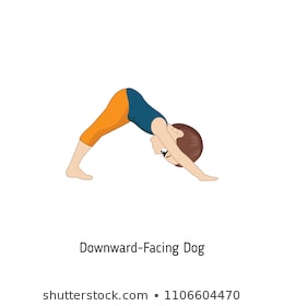
Downward Facing Dog Cartoon Images, Stock Photos & Vectors ...
Downward Dog Pose

Image result for chilean flag
Chile’s pose is the flamingo pose! Chile is home to many different landforms including mountains and deserts. The Chilean flamingo lives in the Atacama desert! Flamingos are pink because of the red and pink pigments in the food they eat.

Flamingo Pose
Flamingo Pose

Image result for kenya flag
Kenya’s pose is the giraffe pose. Kenya is a country in East Africa.There are around 12,000 giraffes in Kenya.    

Giraffe Pose

Flag of Egypt - Wikipedia
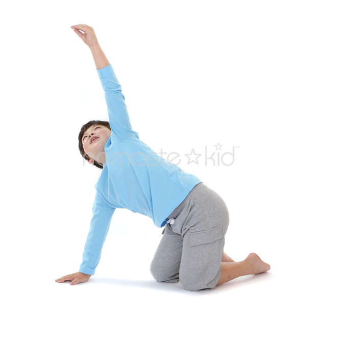
Egypt’s pose is the camel pose. Egypt is a country in the north east part of Africa. In ancient Egypt, camels were used to travel long distances across the Sahara. 

Kids Yoga | Flashcards
Camel Pose

Image result for spain flag
Spain’s pose is the cow pose! In Spain, bull runnings (male cattle) are a common celebratory event each year. 

Farm Animals Yoga (Printable Poster) | Kids Yoga Stories
Cow Pose

Image result for china flag
China’s pose is tiger pose! South China Tigers are an endangered species in China and need to be protected. Tiger Pose Variation 2


Tiger Pose Variation 2
Tiger Pose


India Flag 5ft x 3ft 150cm x 90cm 70 Denier
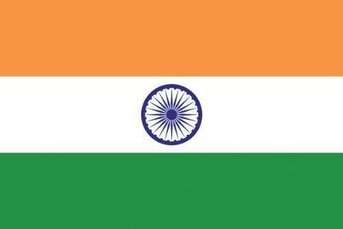
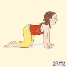
India’s pose is the rhino pose. India is the country where Yoga originated from. The greater one-horned rhino originated from India and is an endangered species. Its scientific name refers to the single horn: Rhinoceros unicornis!

Rhinoceros Pose Yoga | Yoga Sequences, Benefits, Variations, and ...
Rhino Pose

Image result for australia flag
Australia’s pose is the kangaroo pose! Kangaroos are only found in Australia. They have strong legs that allow them to jump everywhere. 
Image result for kangaroo pose for yoga kids | Yoga for kids
Kangaroo Pose

Thinking Globally:
How many continents are represented by these ten countries? Can you find a pose to include the remaining continent?

Earth Day at Home 2020

On the fiftieth anniversary of Earth Day, this year's celebration poses unique challenges for people worldwide. With many celebrations being cancelled and social distancing being required, remote celebrations are necessary. Below are resources for families, children, and individuals to get involved.

  • Get connected with nature virtually. The iNaturalist smartphone app allows the user to scan various forms of wildlife and find out information about insects, animals, or plants. There is also a children's version of the app called Seek by iNaturalist that lets kiddos scan wildlife and earn badges as they get immersed in the nature around them. The best part is that so much nature can be found in your own backyard, which helps make social distancing easier! Full Version of App  Children's App   
  • If you are looking for a more hands-on Earth Day experience, this article provides many ways for adults and kids to get involved. The ideas in this article range for conventional Earth Day activities like cleaning up litter, composting, and planting a tree. Or more out of the box ideas like creating a bug hotel and a nature collage. Get crafty! article
  • Participate in EarthDay.org's 24 hours of action. For the entirety of April 22, for each hour of the day there will be a new way to remotely promote positive changes for the plant. Such as sounding the call for climate action by ringing a bell or blowing a horn outside or sharing your favorite message of hope for the planet with a photograph of the Earth.

  • Some other at home activities for Earth Day are eating dinner by candlelight to conserve electricity, educate yourself on sustainable seafood, or camp in your backyard. Article There is also an Earth Month Scavenger Hunt to the left that is fun for all ages. 
Another fun thing to do on Earth Day is look back and see how far Earth Day celebration has come in 50 years. Here is a link to a CBS New special covering the first ever Earth Day in 1970.  Video 

Enjoy your Earth Day at home! Remember although we can't celebrate together, we can still be together online. Our small efforts at home make a big difference worldwide!  

Thank you to Advanced Global Thinking students for sharing these great resources with us. 

Thursday, April 30, 2020

Massachusetts Town Name Scavenger Hunt

Have you ever thought about where your town got its name from? Why is it called Haverhill, Bridgewater, Plymouth, or Concord? If you are looking for a fun activity to connect to your town’s history, do some research to look back to see where your town's name comes from. 

It is clear that often a town’s name is based on geography and ecological characteristics. For example, if a town often floods, or is nearby a coast, it may have a particular name that has to do with water. An interesting example of a town’s name representing a geographic place is a town in Spain. Originally, the town’s name was “Arroyo Harinoso” or Floury Brook. Then it changed to “Arroyo del Pino” or Pine Brook. The last name change was to “Laguna de la Higueruela” or Stinking Clover Lagoon. You might be asking yourself, ”Why did the town switch its name three times?” This is because the landscape of the town changed due to flooding and climate changes. The area experienced so much precipitation, the town changed from being named after a brook to a lagoon! This is a big change. 

Geographically, a brook is a small stream, like the picture above. A swamp is a low-lying place where water collects. A picture of a swamp is provided to the left. 


It is also interesting to look at a the town EarthView is from, Bridgewater, Massachusetts. You might think Bridgewater is named because it has a lot of bridges and water however, Bridgewater, is named after Bridgwater, England. EarthView co-coordinator Dr. Hayes-Bohanan and his wife Pam, a librarian, have taken a very strong interest in the name, visiting as many Bridgewaters as they can. You can check out their project here: http://bridgewatersproject.blogspot.com/

After reading about this town in Spain and Dr. Hayes-Bohanan's search into different Bridgewaters, I was interested in looking into my hometown, Weymouth, Massachusetts. I learned that Weymouth, MA is named after a coastal town in England. Weymouth, England gets its name from being situated on the river Wey. This makes sense because a mouth of a river is the part where the river opens into another body of water like an ocean. So, if you put Wey + mouth together you get Weymouth.

The two Weymouth’s have a similar population of almost 60,000 people. Weymouth, England is located in the southern part of England. Similarly, Weymouth, Massachusetts is located in the southern part of the state. However, the two places have differences, such as their climates. For example, Weymouth, England has milder and rainier summers. Whereas, Weymouth, Massachusetts has hotter summers and snowier winters. 

Another fun thing to do is look at pictures from the town your New England town is named after. I actually had a friend travel to Weymouth, England last Summer. He took these pictures for me. See if you can find any similarities and differences in the way your town looks compared to the “old" town. The picture to the left  is a gift from Weymouth in New England to Weymouth in old England. 


The picture to the left which says, “Welcome to Weymouth”  is coincidentally in maroon and gold mosaic tiles. These are the school colors of the high school in Weymouth, Massachusetts. 

The final photo to the right is from the Weymouth, England’s coastline. It is interesting to see how the coastline is more rocky whereas beaches in Weymouth, Massachusetts are sandy and rocky.  


Have fun looking back into your town's history to see where it got its namesake from.

Some questions to look into are:


Where is the original town’s name from?
What is the weather like there?
Why does it have the name it has?
Are there any famous people from there?
How many people live there?
How far away is it? 
What does it look like there? (use Google Maps to do this or Google Images)

Resources to get started on your town name quest:
https://www.sec.state.ma.us/cis/cisctlist/ctlistalph.htm 


References:

Sunday, April 19, 2020

EarthView at the State House 2020

Updated Earth Day, April 22


Every year since we acquired EarthView in 2008, we have taken our portable globe classroom to the Massachusetts State House during Earth Week. Our geography faculty, students, and alumni -- along with in-service teachers and student volunteers -- have taken the opportunity to talk about geography with legislators, students, tourists, and marathon runners from all over the world.

This year, sadly, we cannot celebrate Earth Day in person, but we join people from all over the world in virtual celebrations. Please enjoy our greeting video above and then explore some of the Earth Day links gathered by our geography students.

https://www.earthday.org/take-action-now/
Learn more about Earth Day from the Living On Earth interview with Dennis Hayes, the 1970 national coordinator of the day, who remains very much involved in the celebration.

Image may contain: text
From Sen. Anne Gobi's Earth Day Greetings
From Sen. Anne Gobi -- who has hosted many of our State House visits -- we learn that Article 97 of the Massachusetts Constitution stipulates:
The people shall have the right to clean air and water, freedom from excessive and unnecessary noise, and the natural, scenic, historic, and esthetic qualities of their environment; and the protection of the people in their right to the conservation, development and utilization of the agricultural, mineral, forest, water, air and other natural resources is hereby declared to be a public purpose.
For those who have not seen EarthView in action, we recommend this short video by one of our long-term teaching partners.


On the fiftieth anniversary of Earth Day, this year's celebration poses unique challenges for people worldwide. With many celebrations being cancelled and social distancing being required, remote celebrations are necessary. Below are resources for families, children, and individuals to get involved.
  • Get connected with nature virtually. The iNaturalist smartphone app allows the user to scan various forms of wildlife and find out information about insects, animals, or plants. There is also a children's version of the app called Seek by iNaturalist that lets kiddos scan wildlife and earn badges as they get immersed in the nature around them. The best part is that so much nature can be found in your own backyard, which helps make social distancing easier! Full Version of App  Children's App     
  • If you are looking for a more hands on Earth Day experience, this article provides many ways for adults and kids to get involved. The ideas in this article range for conventional Earth Day activities like cleaning up litter, composting, and planting a tree. Or more out of the box ideas like creating a bug hotel and a nature collage. Get crafty! article 
  • Participate in EarthDay.org's 24 hours of action. For the entirety of April 22, for each hour of the day there will be a new way to remotely promote positive changes for the plant. Such as sounding the call for climate action by ringing a bell or blowing a horn outside or sharing your favorite message of hope for the planet with a photograph of the Earth. 
  • Some other at home activities for Earth Day are eating dinner by candlelight to conserve electricity, educate yourself on sustainable seafood, or camp in your backyard. Article There is also an Earth Month Scavenger Hunt to the left that is fun for all ages. 
Another fun thing to do on Earth Day is look back and see how far Earth Day celebration has come in 50 years. Here is a link to a CBS New special covering the first ever Earth Day in 1970.  Video 

Enjoy your Earth Day at home! Remember although we can't celebrate together, we can still be together online. Our small efforts at home make a big difference worldwide!  

Thank you to  students in our new Advanced Global Thinking class for sharing these great resources with us! One of those students advised her own children as part of stay-at-home education: Hug Trees, Not Each Other!

Saturday, March 24, 2018

Measuring the Earth

Dr. Hayes-Bohanan uses Goodreads to share book recommendations; he recently posted a review of a book that students of geography of any age can enjoy. It describes the clever, simple, and remarkably accurate results of the first effort to measure planet earth over 2,000 years ago.

The Librarian Who Measured the EarthThe Librarian Who Measured the Earth by Kathryn Lasky
My rating: 5 of 5 stars

This is written for children, but readers of any age can enjoy and learn from this book. As a geographer married to a librarian, this is a family favorite.

View all my reviews

Friday, February 16, 2018

Foxboro Regional Charter School

N 42° 03' 25" 
W 71° 14' 42"

(including how to look them up by address)

The EarthView team is pleased to be visiting Foxboro Regional for the first time; we have enjoyed many visits to the nearby Ahern School, and are happy to meeting some new students and educators in Foxboro (or Foxborough), a town fairly close to our home base at BSU. In fact, we invite students to compare the coordinates of their school with those of the BSU campus where EarthView is stored and where we do most of our geography teaching. When we do programs on our own campus, we usually use the Kelly Gym, whose coordinates are 41°59'15"N, 70°58'12"W. How does that compare to Foxboro Regional?

We were also delighted to learn that students from Foxboro Regional are preparing to embark on a service trip to Nicaragua! In 2006, EarthView team member Dr. Hayes-Bohanan led a study tour to Nicaragua for what he thought would be a one-time opportunity to learn about coffee with his students. He fell in love with everything about Nicaragua, and has now brought his whole family and more than 120 students to the country during 12 travel courses entitled Geography of Coffee. Several of our EarthView Wranglers (student assistants) have also made the journey, including current team member Jackie.

Thursday, February 8, 2018

Peter W Reilly School, Lowell

N 42° 38' 28" 
W 71° 16' 48"


(including how to look them up by address)

The EarthView Team is pleased to be making its first visit to Peter W. Reilly Elementary, a K-4 school in the historic city of Lowell. It is the second school we have visited in Lowell. The other is the Pyne Arts School, whose coordinates are 42°37'44" N, 71°17'11" W. Looking at the map and reading the coordinates, which purple pin points to which school?


Almost two hundred years ago, Lowell was established as an industrial city, making clothing and other textiles. It was a one of the first and most important factory cities in the United States, an important history that can be explored in its own National Park.
Visitors can learn a lot about the Industrial Revolution in Lowell.
Image: National Park Service
During the 1970s, Lowell was a center of the new computer industry. It was also becoming a destination for people migrating to the United States from Cambodia. Of the 109,000 people in Lowell, about 15,000 are from that Asian country, more than any other U.S. city except for Long Beach, California. Lowell hosts a Cambodian diplomat, the honorary consul Mr. OU Sovann. During our visit, one of our EarthView wranglers will point out Cambodia on EarthView. She is a Bridgewater geography student who completed a biology travel course in Cambodia just last month!

Friday, October 13, 2017

Brennan School, Attleboro -- Oct 13

N 41° 56' 15" 
W 71° 18' 29"
(including how to look them up by address)

The EarthView team is making its first visit to the Brennan School in Attleboro, located about 15 miles to the east of our home base on the main campus of Bridgewater State University.

BSU also has a small campus in Attleboro itself, at 11 Field Road. According to Google Maps, it is only 11 or 12 minutes away from the Brennan School by car.


During our visit, the EarthView team will be explaining the location of the wildfires in California. This tragedy is a perfect example of geography's three questions:
Where is it?Why is it there?So what?
In this case, the "where" question is a very distinctive pattern of two linear clusters along either side of California's Central Valley.
 The timing and location of these fires has to do with the famous Santa Ana winds that affect California (U.S.A.) and Baja California (Mexico). As air cools at high elevations, it becomes more dense, and the high pressure forces it downhill. It becomes drier as it descends, and moves more rapidly as it is pushed through narrow canyons. 

The result is that dust, smoke, and hot air is pushed down slopes, and even far out into the Pacific Ocean.
The reason that the winds come at a predictable time every year is that the global circulation of the atmosphere shifts with the sun. In New England, the most important variables from season to season have to do with temperature and the length of the day, but in many parts of the world, the direction of prevailing winds is even more important.