EarthView team bios, guidelines, and more.

Thursday, January 26, 2012

Smith Elementary, Danvers -- January 27

N 42 ° 35' 10"
W 70 ° 57' 14"
Learn more about Lat/Long (including how to look them up by address)

The EarthView team is pleased to be making another North Shore visit, this time to the Ivan G. Smith School in Danvers. We are even more pleased to find that the Smith School has a newsletter with a perfect name: The Globe.


This is an interesting community in terms of its land and water connections to the entire region. Bordered on almost all sides by waterways, Danvers is criss-crossed by major, historic highways, including Route 1, Route 128, and Interstate 95. 

Our visit comes on January 27, the 124th birthday of the National Geographic Society. The entire EarthView team is looking forward to the Massachusetts portion of the National Geographic Geography Bee this March 30 in Worcester.


Many do not realize that the first president of National Geographic was none other than Alexander Graham Bell -- some of the EarthView team members have visited his personal office in the National Geographic Headquarters in Washington. The second president was his son-in-law, and every president since then has been a descendant.

Danvers was part of Salem during the 1692 Witch Hysteria, and the home of victim Rebecca Nurse still stands in the town. The wife and daughter of EarthView team member Dr. Hayes-Bohanan are among her direct descendants (and distant cousins of at least one Smith School student).

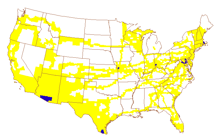
Danvers has something in common with far-away Weslaco, Texas: both originated a specific variety of onion. In the case of Danvers, the onion is named for the town, and vice-versa (Danvers Onion and Onion Town, repsectively). In the case of Weslaco, the onion is named for the road along which it was developed, FM 1015 (Farm-to-Market Road 1015). It is simply called a 1015 onion.

Post-event update: The EarthView team often learns as much as we teach, and the Smith School visit was no exception. The Danvers Onion, it turns out, is among the most commonly sold yellow bulb onions, and Danvers once supplied most of the onions in the surrounding region. Onion Town is also known for the Danvers Carrot, a short variety bred especially for the clay-rich soils found in Danvers. These carrots are known as "half long" and are among the most popular baby-food carrots.

The clay soil deposits that make short carrots easier to grow than long ones are also good for an industry that Danvers historically shared with Bridgewater. In both towns, the glaciers left clay behind that was good for making bricks.

As we left Danvers, we noticed a fine example of what geographers call "sense of place." The owners of this restaurant have a geographic sense of humor: its function room is named for the famous onion of a town in Georgia.

Monday, January 23, 2012

The Presidential Map

A June 29 2009 blog post, The Presidential Map, shows Earthview fans that the Commander-in-Chief appreciates Geography!

Where is Boston?


When viewed at a global or even a national scale, almost all of the schools we visit with the EarthView program are located in the "greater Boston" area. The actual boundaries of the city are, however, much more constrained, encompassing less than 50 square miles. In a recent Boston Globe article, Welcome to Megaboston, Chris Marstall describes a proposal that would have made the city itself more than six times larger, and with a population more than three times the current number.

This is a great story to use in reviewing the Five Themes of Geography:
  • Location
  • Place
  • Human-Environment Interactions
  • Movement
  • Regions

Which themes does this story illustrate must easily? Which themes are more difficult to find in this story? What kinds of regions are described in this story?

Most importantly: What do you think of as Boston? Greater Boston?

Jane Goodall, Geographer

Jane Goodall is known for her work with chimpanzees and for her work around the world encouraging young people to get involved in environmental protection, both locally and globally. Her Roots & Shoots organization provides a great opportunity for students to make a difference in the world, both locally and globally.

Because of this work, Dr. Goodall was the first person ever to receive the Atlas Award from the Association of American Geographers. Several members of the EarthView team were delighted to be in Washington DC for that presentation in April, 2010. We will never forget the chimpanzee greeting with which she opened her acceptance speech!

Friday, January 20, 2012

County Map Project

Today at the Burkland and Goode Schools, I mentioned the County Map Project to several groups of students. This is a geographic "life list" that I began while living in Ohio more than 20 years ago. The project began with paper maps of the United States, on which I would shade in the counties I had visited at any time in my life. I encouraged my wife Pamela and several friends to take up the hobby, and eventually created this online version of the map, including larger-scale maps of each state.

A few years ago, I began to create a third-generation version of the project, using Geographic Information Systems, but have not yet completed the transition. As it stands now, I need to revise the maps, as I have visited many counties in Michigan -- and a few in New York, Vermont, and Maine -- since the last update!

I am not alone in this hobby. The Extra Miler Club is for people throughout the United States who enjoy going out of their way to visit new places, county by county.

Thursday, January 19, 2012

Burkland and Goode Schools, Middleborough -- January 20

Henry B. Burkland: N 41° 53' 12"  W 70° 54' 37"
Mary K. Goode:      N 41° 53' 14"  W 70° 54' 42"
Learn more about Lat/Long (including how to look them up by address)

We are very pleased to begin 2012 with a visit to the Burkland and Goode Schools, adjacent schools in the town of Middleborough, to our south. Here it is worth noting that EarthView is usually stored in the Geography Department of the Conant Science & Math Center at Bridgewater State University. Using the same method to find coordinates as we used above, that location is:

Conant Science & Math Center: N 41° 59' 17"  W 70° 58' 19"

This information is not perfectly accurate; each set of coordinates is the average of three estimates of latitude and longitude that are based on the postal addresses of each building. Geographers who need more detailed information would work directly from topographic maps or GPS to get a more accurate reading, or to select a specific point -- such as the entrance or the center of the building -- on which to base the estimate.
How far apart are the neighboring schools?

Assuming the estimates are reasonably accurate, however, we can use the coordinates to answer a few questions:

How many degrees, minutes, and seconds did EarthView travel to reach these schools?
How far apart are the schools in degrees, minutes, and seconds?
Which school is farther west? Which is farther north?
Where are both schools relative to the Geography Department -- are they east or west, north or south?

January 20

Our EarthView blog often includes significant anniversaries related to our visit. This one takes place on January 20, which is the date of more than the usual number of events that are important in history AND geography. It is the anniversary of every U.S. presidential inauguration since 1937, as well as many other significant events.

For example, on this date in 1986, a new word was made known to the world, as the "Chunnel" was proposed. Completed in 1994, the "Channel Tunnel" connects Great Britain to France, spanning the English Channel. By connecting this major island to the mainland, it changed the geography of Europe profoundly.